
The finale of a trifecta of clippers pushing across the Prairies in recent days will be the most notable for Alberta as it continues its trek on Sunday.
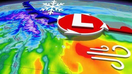
There will be a one-two winter punch of snow and blustery winds, with strong, downsloping gusts off the Rockies that could reach up to 100 km/h in some southern areas. Wind warnings are in place.
DON’T MISS: Popular Canadian tourist destination sees driest winter on record
The system will also be bringing some welcome snow for the ski enthusiasts, especially in snow-starved Banff region, with an atmospheric river washing over British Columbia’s coast being the culprit for the series of back-to-back clippers over the Prairies.
But that also means snow for the lower-elevated communities, too, so expect slippery road conditions and difficult travel on Sunday, especially in areas also hit hard by the potent wind gusts. Edmonton, Alta., could see 5-10 cm of snow through Monday, accompanied by a noticeable temperature plummet to start the week once the low departs.
Sunday-Monday: Snow and blustery winds develop over the Rockies
Snow that kicked off over the Rockies on Saturday night will continue through Sunday, and into Monday.
The snow will be a welcomed sight for popular skiing and tourist destinations that have been impacted by a below-average season so far, such as Jasper, Banff, and Lake Louise.

Banff has only received 321 cm of snow so far this season, compared to the average 590 cm of snow we would typically see by now.
Jasper has not fared any better, only receiving 89 cm so far—well below the average of 302 cm.
SEE ALSO: Want to learn how to ski? Here are five tips to help get you started!
There may be some impacts along the Yellowhead Highway as a swath of moderate snowfall sits over the area. To the east, Edmonton is now looking at 5-10 cm of snow with this system.

Meanwhile, Calgary will be seeing minimal snow impacts as the bulk of the snow stays over higher elevations.
However, Calgary will be on the receiving end of intense wind gusts on Sunday, prompting warnings from Environment and Climate Change Canada (ECCC).
“Damage to buildings, such as to roof shingles and windows, may occur. Loose objects may be tossed by the wind and cause injury or damage. Motorists, especially in high profile vehicles, may expect hazardous driving conditions on highways subject to strong crosswinds,” ECCC said in the wind warning.

Winds will be pretty punchy across southern Alberta, not just Calgary, as strong, downsloping gusts develop off the Rockies. Gusts up to 100 km/h are possible:
-
Calgary: 80 km/h
-
Lethbridge: 90 km/h
-
Pincher Creek: 90 km/h
-
Medicine Hat: 70 km/h

Monday is a major reality check as cold air sweeps across the south end of the province, sending temperatures below freezing as the low passes east.
Stay with The Weather Network for more forecast information and updates on your weather across Alberta.